Ordnance Survey
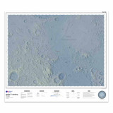
Apollo 11 Landing: Map of the Moon - Flat Map
Free delivery on all orders (more info)
Back by popular demand, Ordnance Survey have re-released this map of the Moon which was originally released for the 50th Anniversary of the Apollo 11 landing.
"That's one small step for man; one giant leap for mankind."
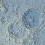
Ordnance Survey have created this map of the moon using a height data made available by NASA, captured by the Lunar Orbiter laser Altimeter (LOLA) and the Kaguya Terrain Camera, and then shaded to show the heights.
This is a flat map, that will come rolled in a tube.
The map approximately measures W 1000 x H 890 mm.
Reviews
Delivery times
For last order dates to guarantee your order in time for Christmas, please see delivery information here.
Order before 3pm weekdays for:
- Free standard delivery in up to five working days
- 1st Class delivery in 1-2 working days
- Priority Express Next Day delivery on the next working day
OS Historical 1896-1904 Maps, Relief Maps and Custom Made Map orders will take one extra day for printing. Framed and canvas products are handmade and usually take 10-12 working days to dispatch. If you order on a bank holiday we'll start on your order on the next working day. Standard delivery for OS Historical 1896 - 1904 Maps and Relief Maps are sent RM 48, and Next Day Delivery will be sent out Royal Mail 24.
An estimated delivery date will be shown in checkout once you enter your address and pick a delivery option.
Sorry, we do not currently deliver outside of the UK.
See Full Delivery information here.


