Ordnance Survey
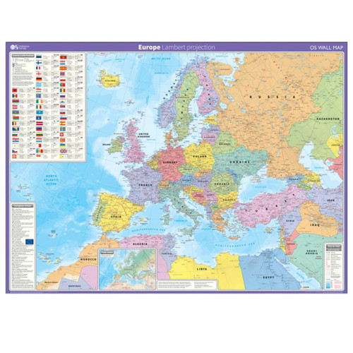
Europe - wall map
This wall map of Europe is shown in the Lambert Azimuthal equal area projection. This gives a map showing accurate sizes of countries, but with some distortion of the shapes. It shows international boundaries, major cities, towns, physical relief, key roads and rivers. It also has an inset with information on population, land area, currency, national flag, time zone and more.
This map is gloss coated, so can be used with dry-wipe pens and is supplied flat and rolled in a cardboard storage tube. It's ideal for students, businesses or display.
Size: 1,235mm X 912mmScale: 1:6 000 000

Write on, wipe off
Write, scribble, & doodle with a dry marker until your heart’s content. Our Wall Maps are perfect for plotting routes, marking where you’ve been, as well as a great educational tool

Varying Scales
Our Wall Maps are for display purposes only, scales may vary and may not be 100% accurate

Perfect for schools & offices
Perfect size & excellent detail, our wall maps are a great resource for offices and the classroom

Topographic mapping
Highly detailed contour mapping highlighting variations in terrain and everything you would expect from a map
Delivery times
Order before 3pm weekdays for:
- Free standard delivery in up to five working days
- 1st Class delivery in 1-2 working days
- Priority Express Next Day delivery on the next working day
Custom Made map orders will take one extra day for printing. Framed and canvas products are handmade and usually take 10-12 working days to dispatch. If you order on a bank holiday we'll start on your order on the next working day.
An estimated delivery date will be shown in checkout once you enter your address and pick a delivery option.
Sorry, we do not currently deliver outside of the UK.
See Full Delivery information here.


