Ordnance Survey
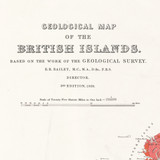
Geological Map of the British Islands 1939 - Flat Map
Free delivery on all orders (more info)
Limited stock available
Our vintage Geological Map of the British Islands is based on the work of the Geological Survey, engraved by Ordnance Survey, and first published in 1904.
This is an authentic reproduction of the 3rd edition that was first published in 1939. Originally printed on sheets 92 x 68 cm. Ordnance Survey have enhanced image of the original map from the National Library of Scotland for republication.
Scale of Twenty Five Statute Miles to One Inch.
This is a flat map, that will come rolled in a tube.
The map approximately measures W 1000 x H 890 mm.
Need help finding a map? View all Historical maps in an overview map.

Great for educators and enthusiasts
We offer a wide range of historical maps that are excellent tools for teaching and research, as well as wonderful display items for any enthusiast

Excellent detail
Cross reference them with modern maps to see how the landscape has changed over time, discover something new in the old

Hand drawn
All our historic maps are exquisitely detailed, hand-drawn from days gone by

Accurate Reproductions
Get that authentic feel with high quality scans taken from the original artefact
Reviews
Delivery times
Order before 3pm weekdays for:
- Free standard delivery in up to five working days
- 1st Class delivery in 1-2 working days
- Priority Express Next Day delivery on the next working day
OS Historical 1896-1904 Maps, Relief Maps and Custom Made Map orders will take one extra day for printing. Framed and canvas products are handmade and usually take 10-12 working days to dispatch. If you order on a bank holiday we'll start on your order on the next working day. Standard delivery for OS Historical 1896 - 1904 Maps and Relief Maps are sent RM 48, and Next Day Delivery will be sent out Royal Mail 24.
An estimated delivery date will be shown in checkout once you enter your address and pick a delivery option.
Sorry, we do not currently deliver outside of the UK.
See Full Delivery information here.


