Ordnance Survey
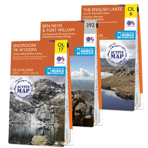
OS Explorer National Three Peaks Challenge map set
The National Three Peaks map set covers the top summits in stunning colour detail, with every track and path clearly marked to help you complete your challenge. You save 20% by buying them as a set.
With all OL maps in this set you will receive a code for use on your iOS or Android smartphone or tablet.
The maps included are: Sheet 392 Ben Nevis and Fort William, OL6 The English Lakes: South Western Area and OL17 Snowdon.
The mountains climbed, in order of elevation, are Ben Nevis in western Scotland, 1,344 metres (4,409 ft), Snowdon in North Wales, 1,085 metres (3,560 ft), and Scafell Pike in The Lake District, 978 metres (3,209 ft). The peaks are usually climbed in the order: Ben Nevis in the evening, Scafell Pike in the early morning and Snowdon in the mid- to late-afternoon.
Ben Nevis is the highest and the hardest of the national three peaks, a gruelling uphill struggle and very tough on the knees going back down. The main path up 'The Ben' is obvious can be done in fading light as long as you find the right path down. Scafell Pike has many start points and paths to the top, but they are less clear. There are also numerous routes up Snowdon, from the easier and popular routes like the Pyg Track to the potentially scary Crib Goch ridge.
Average time for Snowdon is 4 hours, with 5 hours each for both Ben Nevis and Scafell Pike, (14 hours total) plus a maximum of 10 hours travel time between the start and end points of the 3 peaks. Doing the challenge in a group for charity is now the most popular way and has the added benefit of wide-awake drivers.
After scaling the three highest peaks you'll almost certainly want to go back and try one or more of them again.

Brave the elements
Our three peaks selection come in standard and weatherproof, meaning you’re prepared for all eventualities

Topographic mapping
Highly detailed contour mapping highlighting variations in terrain and everything you would expect from a map

Take on the challenge
The most detailed maps of Britain’s ‘Three Peaks’ Scaffel Pike, Ben Nevis, and Snowdon

Not sure which map you need?
Discover which area this map covers with the map area overview below or read more about our different types of maps
Delivery times
Order before 3pm weekdays for:
- Free standard delivery in up to five working days
- 1st Class delivery in 1-2 working days
- Priority Express Next Day delivery on the next working day
Custom Made map orders will take one extra day for printing. Framed and canvas products are handmade and usually take 10-12 working days to dispatch. If you order on a bank holiday we'll start on your order on the next working day.
An estimated delivery date will be shown in checkout once you enter your address and pick a delivery option.
Sorry, we do not currently deliver outside of the UK.
See Full Delivery information here.
Reviews
What area is covered by the map?
Use the map below to see if areas are on this map or will be on another sheet. Click on any box to see the map for the area.
Sorry, this map is out of stock


