Historic Maps

Learn about the history of the Great Britain or the world. Understand the changing landscape with a collection of historical maps from Ordnance Survey and others. Compare an old historical map to a modern map and see how towns and cities have grown, rivers changed course, and roads and rail built and demolished.

  • Out of stock
    Black and white reproduction historical map of Great Yarmouth and wider area
    Great Yarmouth 1896-1904

    Ordnance Survey

    £8.99
  • Out of stock
    Black and white reproduction historical map of Thetford and wider area
    Thetford 1896-1904

    Ordnance Survey

    £8.99
  • Out of stock
    Black and white reproduction historical map of Settle and wider area
    Settle 1896-1904

    Ordnance Survey

    £8.99
  • Out of stock
    Black and white reproduction historical map of Arbroath and wider area
    Arbroath 1896-1904

    Ordnance Survey

    £8.99
  • Out of stock
    Black and white reproduction historical map of Tenterden and wider area
    Tenterden 1896-1904

    Ordnance Survey

    £8.99
  • Out of stock
    Black and white reproduction historical map of Abergavenny and wider area
    Abergavenny 1896-1904

    Ordnance Survey

    £8.99
  • Out of stock
    Black and white reproduction historical map of Tynemouth and wider area
    Tynemouth 1896-1904

    Ordnance Survey

    £8.99
  • Out of stock
    Black and white reproduction historical map of Wolsingham and wider area
    Wolsingham 1896-1904

    Ordnance Survey

    £8.99
  • Out of stock
    Black and white reproduction historical map of Whithorn and wider area
    Whithorn 1896-1904

    Ordnance Survey

    £8.99
  • Out of stock
    Black and white reproduction historical map of Mull and wider area
    Mull 1896-1904

    Ordnance Survey

    £8.99
  • Out of stock
    Black and white reproduction historical map of Pembroke and wider area
    Pembroke 1896-1904

    Ordnance Survey

    £8.99
  • Out of stock
    Black and white reproduction historical map of Dinas Mawddwy and wider area
    Dinas-Mawddwy 1896-1904

    Ordnance Survey

    £8.99
  • Out of stock
    Black and white reproduction historical map of Epping and wider area
    Epping 1896-1904

    Ordnance Survey

    £8.99
  • Out of stock
    Black and white reproduction historical map of Hay and wider area
    Hay 1896-1904

    Ordnance Survey

    £8.99
  • Out of stock
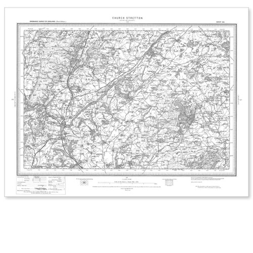
    Black and white reproduction historical map of Church Stretton and wider area
    Church Stretton 1896-1904

    Ordnance Survey

    £8.99
  • Out of stock
    Black and white reproduction historical map of Shrewsbury and wider area
    Shrewsbury 1896-1904

    Ordnance Survey

    £8.99
  • Out of stock
    Black and white reproduction historical map of Guisborough and wider area
    Guisborough 1896-1904

    Ordnance Survey

    £8.99
  • Out of stock
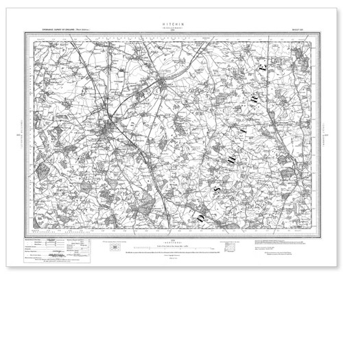
    Black and white reproduction historical map of Hitchin and wider area
    Hitchin 1896-1904

    Ordnance Survey

    £8.99
  • Out of stock
    Black and white reproduction historical map of Stamford and wider area
    Stamford 1896-1904

    Ordnance Survey

    £8.99
  • Out of stock
    Black and white reproduction historical map of Rhayader and wider area
    Rhayader 1896-1904

    Ordnance Survey

    £8.99
  • Out of stock
    Black and white reproduction historical map of Swanage and wider area
    Swanage 1896-1904

    Ordnance Survey

    £8.99
  • Out of stock
    Black and white reproduction historical map of Kirkcudbright and wider area
    Kirkcudbright 1896-1904

    Ordnance Survey

    £8.99
  • Out of stock
    Black and white reproduction historical map of Welshpool and wider area
    Welshpool 1896-1904

    Ordnance Survey

    £8.99
  • Out of stock
    Black and white reproduction historical map of Northampton and wider area
    Northampton 1896-1904

    Ordnance Survey

    £8.99