Ordnance Survey
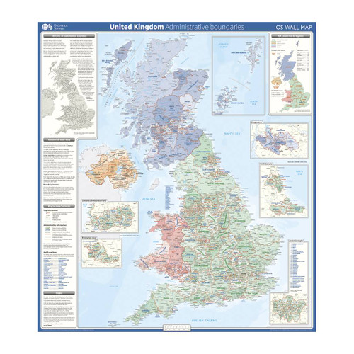
United Kingdom - administrative boundaries wall map
This wall map shows the National, County and Unitary Authority administrative boundaries in the United Kingdom. There is also an insert showing the historical counties and the UK regions. This wall map is ideal for students, businesses or for decoration
Supplied flat, rolled in a storage tube for storage. This map is gloss coated, so can be used with dry-wipe pens.

Write on, wipe off
Write, scribble, & doodle with a dry marker until your heart’s content. Our Wall Maps are perfect for plotting routes, marking where you’ve been, as well as a great educational tool

Varying Scales
Our Wall Maps are for display purposes only, scales may vary and may not be 100% accurate

Perfect for schools & offices
Perfect size & excellent detail, our wall maps are a great resource for offices and the classroom

Topographic mapping
Highly detailed contour mapping highlighting variations in terrain and everything you would expect from a map
Delivery times
Order before 3pm weekdays for:
- Free standard delivery in up to five working days
- 1st Class delivery in 1-2 working days
- Priority Express Next Day delivery on the next working day
Custom Made map orders will take one extra day for printing. Framed and canvas products are handmade and usually take 10-12 working days to dispatch. If you order on a bank holiday we'll start on your order on the next working day.
An estimated delivery date will be shown in checkout once you enter your address and pick a delivery option.
Sorry, we do not currently deliver outside of the UK.
See Full Delivery information here.


