Pathfinder
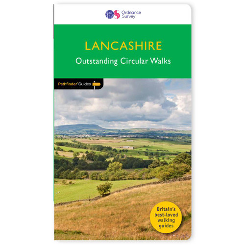
Lancashire Walking Guidebook - OS Pathfinder Guides
170 miles of invigorating walking across the county embracing secluded and delightful Arnside and Silverdale . . .
Explore 28 beautiful walks across Lancashire with the OS Pathfinder Guidebooks, graded by length and vary in difficulty. The routes range from extended strolls to longer hikes, something for all levels! Lancashire is a county of surprising diversity from its great industrial heritage towns to its attractive rural villages and its number of historic monuments. Its a true gem for walkers. Each walk includes a detailed description, an OS map, GPS waypoints and notes of key features and things to see.There can be no better way of exploring Lancashire than by foot: there are a number of long distance paths, both coastal and inland. Discover a great number of circular walks in highly distinctive surroundings, including the Lune Valley, Formby Point, and Forest of bowland.This is one of a serious of books with great walking routes covering the most popular and scenic areas of Britain. Printed with weather-resistant covers featuring durable rounded corners, they are the perfect companion for country walking throughout Britain.
Publication Date: 2018
Walks in this book:
- Haslingden Grane
- Crook o'Lune
- Parblod Hill and Fairy Glen
- Knott End
- Leighton Moss
- Around Silverdale
- Holcombe Moor
- Darwen Moor
- Rivington Country Park
- Garstang and the Lancaster Canal
- Haigh
- Hurst Green
- Wycoller and the Forest of Trawden
- Clougha Pike
- Around Alden Brook
- Sabden and Spence Moor
- Gisburn
- Downham and Sawley Abbey
- Salterforth
- Pendle Hill
- Glasson Dock and Cockersand Abbey
- Carnforth
- Jumbles, Entwistle, and Wayoh
- Scorton, Nicky Nook, and Grize Dale
- Blackstone Edge
- Bowland Knotts
- Anglezarke, White Coppice, and Great Hill
- Langden Valley, Fair nape Fell, and Totridge

All-inclusive
Whether you’re looking for a long stroll or an exhilarating hike, there is something for everyone

Tried and True
All routes are tried and tested by seasoned walkers

Discover more
The best way to discover what an area has to offer. All walks are rated for difficulty

Durable & Weatherproof
Never get caught out in a storm with our durable and weatherproof Pathfinder guidebooks
Delivery times
Order before 3pm weekdays for:
- Free standard delivery in up to five working days
- 1st Class delivery in 1-2 working days
- Priority Express Next Day delivery on the next working day
Custom Made map orders will take one extra day for printing. Framed and canvas products are handmade and usually take 10-12 working days to dispatch. If you order on a bank holiday we'll start on your order on the next working day.
An estimated delivery date will be shown in checkout once you enter your address and pick a delivery option.
Sorry, we do not currently deliver outside of the UK.
See Full Delivery information here.


